3.2 Map Weighting
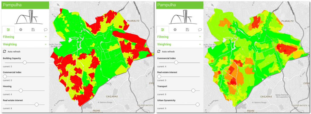
The map weighting section allows the filtered maps to be overlapped and weighted on the basis of their priority.
The aim of the map weighting section is to provide users with a tool for analysing the localisation of expected effects of specific elements and evaluating the sum of effects on the basis of a specific mathematical curve associated to the layers.
On the basis of a green-yellow-red gradient colour scale, InViTo shows where specific requested aspects are present (green colour) or absent (red colour).

The weighting section can be used to determine the presence of specific elements in an area and to understand the influence of these elements on their surroundings. Combining the effects of each aspect, InViTo generates one single map which highlights the suitability of the area to respond to a specific question according to the chosen parameters. Through the resulting maps, actors could understand which areas already had the requirements to fit their preferences. InViTo can be useful in suggesting new planning decisions, providing responses in real time to “what if” questions and displaying the effects of planning choices.
This section is an on-going part of the research. In fact, the map weighting is currently based on the sum of maps as in the basic methodology of Multicriteria Decision Analysis (MCDA) [1]. Further developments of InViTo will improve this section in order to integrate the opportunity to develop MCDA directly in the tool as the spatial Multicriteria Analyses combining GIS and MCDA [2, 3].
The weighting section is set as follows:
- It is composed by a set of slider cursors, which allow users to set the importance of each element on a scale from -10 to 10. Negative values should be assigned to those elements which have a negative influence to be near the other elements, while positive values should be for attractors nodes.
- The computing can be performed not only on regular grids but in any kind of irregular grid.
- The calculation of values can be given not only by a function of distance as in the previous version of the tool, but also by considering a proper value of each single cell.
- The mathematical curves, that calculate the effect of an element on land, can be easily set up by users through a specific submenu of InViTo named “curve configuration”.
The weighting section includes a further range filter, which allows weighted maps to be filtered on the basis of their resulting values. By this filter, users can select the areas which respond to a specific range of selected criteria and visualise which areas are over or under a specific threshold or comprised between a defined range.
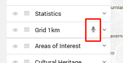
The “Listeners data” layer is signed with a microphone near the layer’s name.
[1] Figueira, J., Greco, S., & Ehrgott, M. (Eds). (2005). Multiple Criteria Decision Analysis:State of the Art Surveys. New York, NY, USA: Springer.
[2] Malczewski, J. (1999). Gis and Multicriteria Decision Analysis. New York, NY, USA: Wiley.
[3] Ferretti V. (2013). Le Analisi Multicriteri spaziali a supporto delle procedure di pianificazione e valutazione: analisi e classificazione della letteratura scientifica, Geoingegneria Ambientale e Mineraria, (2), 53-66.
