– Appearance setting
The appearance setting of geometries should be done layer by layer, field by field.
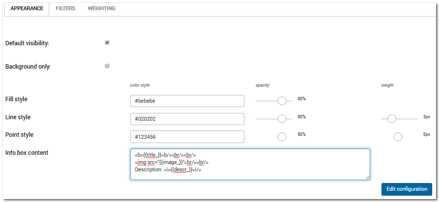
In the appearance menu, “project contributors” users can choose choose the basic aspect of all geometries when no map style is enabled.
A difference is considered among points, lines and areal geometries as well as in GIS data. For all of these elements, a colour, a dimension and a level of opacity have to be assigned.
A checkbox allows users to decide if the layer should be visible when opening the project, and if the layer can be filtered by the final user or it should be used only as a background image.
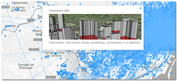
An info box content window can be compiled in order to have a pop-up window for each geometry when double-clicking on it in the front interface.
The info bow window should be compiled in html. Here below an example shows the content of an info-box window where:
- the title of the image, included in the database field named “title_”, is in bold.
- a picture of the geoemtry is loaded from an url contained in the database field named “image_”.
- a description (in italic style) of the feature is loaded from the database field named “descr_”
<b>{{title_}}<b/><br/>
<img src="{{image_}}"<br/>
Description: <i>{{descr_}}<i/>
The pop-up window containing the info box. It appears when double-clicking on a geometry in the map window.

